Oil Pollution Hot Spots
The Mopang Case
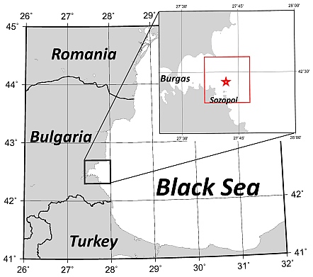
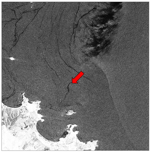
On 1 July 1921, the US cargo steamship SS Mopang sank off Sozopol on the Bulgarian Black Sea coast, close to the city of Burgas, after hitting a sea mine that was left from World War I. For almost one century, the wreck, lying at a depth of about 30 m, was of interest only to marine fauna and scuba divers. On 12 August 2018, however, local newspapers reported an oil leakage that was observed after a period of strong winds and currents in that area. Heavy fuel, of which the SS Mopang had originally loaded 650 tons, was leaking out of the wreck’s tanks.
Location of the wreck of the SS Mopang (red star in the small map) on the Bulgarian Black Sea coast. The red frame marks the location of the SAR image details shown below.
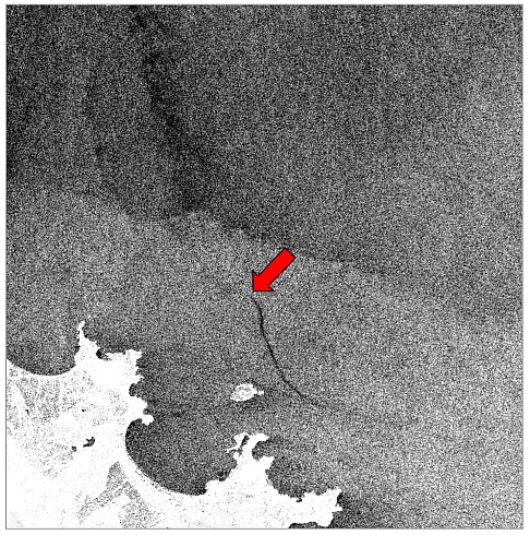
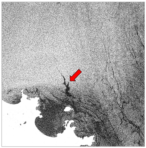
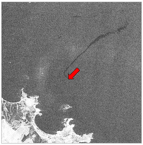
Routinely acquired SAR imagery can be used to monitor the leakage of heavy fuel out of the ship wreck off the Bulgarian coast. The spill of the SS Mopang also shows up on ALOS-2 PALSAR imagery, which indicates that the leakage of heavy fuel had been strong enough to cause a thick oil spill that can be seen on L-band SAR imagery. Our current research is directed towards estimates of the total amount of heavy fuel that had already leaked out when the draining eventually started.
Data
SAR Examples
Sensor |
Acquisition Date |
SAR Image |
Sentinel 1A SAR-C |
5 September 2018 |
|
Sentinel 1A SAR-C |
7 July 2018 |
|
ALOS-2 PALSAR-2 |
13 August 2017 |
|
ALOS-2 PALSAR-2 |
21 June 2015 |
|
Results
Publications
- Gade, M., 2019: Longterm Release of Oil From a Wreck in the Black Sea Monitored by Spaceborne SAR. Proceed. Intern. Geosci. Remote Sens. Sympos. (IGARSS) 2019, Yokohama, Japan, 28 July - 2 August 2019.

 .. back to the KFEW3O page ...

