|
Size: 1683
Comment:
|
Size: 1510
Comment:
|
| Deletions are marked like this. | Additions are marked like this. |
| Line 14: | Line 14: |
| ||'''Date''' ||'''Satellite''' ||'''Time UTC''' ||'''Region''' ||'''Band/Polarization''' ||'''Mode / Pixel''' ||'''Incidence Angle / Heading''' ||'''Processing''' ||'''Weather Data''' ||'''Comments''' || ||||||||||||||||||||||||<style="text-align: center;">'''''2012''''' || || || ||**:** || || ||*.* m ||*.*° || ||*.* m/s *° (Station)|| || ||||||||||||||||||||||||<style="text-align: center;">'''''2011''''' || ||11.10.11 ||TerraSAR-X ||03:44 ||Blue Bight ||X-Band HH || SM / 1.25 m ||28.8° / 191.0° || ||5kt NE || || ||11.10.11 ||Radarsat-2 ||03:37 ||Blue Bight ||C-Band VV || SLC / 1.33 m ||37.0° / || ||5kt NE || || ||08.10.11 ||TanDEM-X ||15:15 ||Blue Bight ||X-Band HH || SM / 1.25 m ||35.3° / 349.7° || ||5kt SW || || ||04.10.11 ||Radarsat-2 ||03:41 ||Blue Bight ||C-Band VV || SLC / 1.33 m ||32.2° / || ||5kt NW || || ||30.09.11 ||Radarsat-2 ||15:17 ||Blue Bight ||C-Band VV || SLC / 1.33 m ||31.3° / || ||5kt S || || ||30.09.11 ||TerraSAR-X ||03:44 ||Blue Bight ||X-Band HH || SM / 1.25 m ||28.8° / 191.0° || ||5kt S || || ||29.09.11 ||TerraSAR-X ||04:58 ||SE Baltic ||X-Band VV || SC / 8.25 m ||40.2° / 190.3° || ||10kt NE || || ||28.08.11 ||TerraSAR-X ||05:15 ||SE Baltic ||X-Band VV || SC / 8.25 m ||25.2° / 192.7° || ||15kt N || || |
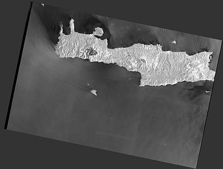
||'''Date''' ||'''Time UTC''' ||'''Satellite''' ||'''Region''' ||'''Center Coord.''' ||'''Band / Pol.''' ||'''Mode / Pixel''' ||'''Inc.Angle / Pass''' ||'''Quicklook''' ||'''Weather Data''' ||'''Comments''' || ||02.03.18 ||04:24 ||Sentinel-1A ||Crete ||34.934°N 24.346°E ||C-Band VV,VH || IW / 10 m ||30.7°-46.2° / DESC ||[[attachment:S1A_IW_GRDH_1SDV_20180302T042410_20180302T042435_020831_023B8A_7ABA_TC_Amplitude_VV.jpg|{{attachment:S1A_IW_GRDH_1SDV_20180302T042410_20180302T042435_020831_023B8A_7ABA_TC_Amplitude_VVs.jpg|attachment:S1A_IW_GRDH_1SDV_20180302T042410_20180302T042435_020831_023B8A_7ABA_TC_Amplitude_VVs.jpg|height="100"}}]] || || || ||01.03.18 ||16:22 ||Sentinel-1A ||Crete ||35.122°N 24.291°E ||C-Band VV,VH || IW / 10 m ||30.6°-46.5° / ASC ||[[attachment:S1A_IW_GRDH_1SDV_20180302T042410_20180302T042435_020831_023B8A_7ABA_TC_Amplitude_VV.jpg|{{attachment:S1A_IW_GRDH_1SDV_20180302T042410_20180302T042435_020831_023B8A_7ABA_TC_Amplitude_VVs.jpg|attachment:S1A_IW_GRDH_1SDV_20180302T042410_20180302T042435_020831_023B8A_7ABA_TC_Amplitude_VVs.jpg|height="100"}}]] || || || |
MSM72
Cruise Data
Satellite Data
Table of all SAR Data
Date |
Time UTC |
Satellite |
Region |
Center Coord. |
Band / Pol. |
Mode / Pixel |
Inc.Angle / Pass |
Quicklook |
Weather Data |
Comments |
02.03.18 |
04:24 |
Sentinel-1A |
Crete |
34.934°N 24.346°E |
C-Band VV,VH |
IW / 10 m |
30.7°-46.2° / DESC |
|
|
|
01.03.18 |
16:22 |
Sentinel-1A |
Crete |
35.122°N 24.291°E |
C-Band VV,VH |
IW / 10 m |
30.6°-46.5° / ASC |
|
|
.. back to the internal SARCurrent Page ...
.. or to the SARCurrent Page ...
.. or to the FEW3O Page (in German) ...

