|
Size: 2052
Comment:
|
← Revision 78 as of 2022-06-21 17:51:37 ⇥
Size: 2554
Comment:
|
| Deletions are marked like this. | Additions are marked like this. |
| Line 1: | Line 1: |
| #acl MartinGade:read,write,delete,revert FINO2Group:read,write all:read | #acl MartinGade:read,write,delete,revert KFEW3O/FINO2Group:read,write All:read |
| Line 5: | Line 5: |
| = FEW³O-Gruppe am IfM = FEW³O steht für Fernerkundung von Wechselwirkungen an der Wasseroberfläche. Mitglieder der Gruppe beschäftigen sich mit Messungen von (Gas-) Austauschprozessen im Labor (Windwellenkanal), mit Feldmessungen der Radarrückstreuung von der Meeresoberfläche oder mit der systematischen Analyse von Satellitenbildern, vor allem von küstennahen Seegebieten. |
= Scatterometer Measurements on FINO2 = |
| Line 8: | Line 7: |
| === Windwellenkanal === Der Windwellenkanal der Uni Hamburg wurde in den frühen 1970er Jahren gebaut und befindet sich auf dem Gelände der Bundesanstalt für Wasserbau, Außenstelle Küste, in Hamburg-Rissen. |
----- [[http://www.fino2.de|FINO2]] is the second research platform of the FINO series (FINO = Forschungsplattformen in Nord- und Ostsee; Research Platforms in the North and Baltic Seas) and the only platform in the Baltic Sea. It is located at Kriegers Flak in the Western Baltic Sea, north of the island of Hiddensee, south of the city of Trelleborg and east of the island of Møn, at 55°00'24,94" N 13°09'15,08" E. FINO2 is run by the [[http://www.gl-garradhassan.com/|Germanische Lloyd Garrad Hassan]]<<BR>><<BR>> |
| Line 11: | Line 10: |
| Weitere Informationen gibt es auf der [[http://www.ifm.zmaw.de/~wwwrs/WWK/UHH_WWK_main.html|WWK-Homepage]]. | . {{attachment:FINO2.jpg|FINO2|width="400"}} . ~-Photograph of FINO2.-~<<BR>><<BR>> |
| Line 13: | Line 13: |
| === Forschungsplattform FINO2 === Seit Juli 2008 finden auf der Forschungsplattform FINO2 in der Westlichen Ostsee systematische Messungen der Radarrückstreuung von der Wasseroberfläche statt. Fest installiert ist dort die Plattformversion des Multi³Scat der Uni Hamburg, mit dem in 5 Radar-Frequenzbändern und 4 Polarisationskombinationen rund um die Uhr Messungen gemacht werden. |
---- == Systematic Measurements on FINO2 == In the frame of the BMBF project SOPRAN systematic measurements of the radar backscattering from the sea surface were carried out on FINO2 from summer 2011 thru autumn 2013. Installed was the platform version of U Hamburg's !Multi³Scat, which allowed continuous radar backscatter measurements at five frequencies and four polarization combinations.<<BR>><<BR>> |
| Line 16: | Line 17: |
| Einige Informationen zu FINO2 findet man [[http://www.fino2.de|hier]]. | . {{attachment:Multi3ScatAntenna.jpg|M3S antenna|width="500"}} . ~-Wideband antenna of !Multi³Scat on FINO2.-~<<BR>><<BR>> |
| Line 18: | Line 20: |
| === Satellitenbilder === Regelmäßig werden Satellitenbilder ausgewertet, vor allem solche, die mit einem Synthetik-Apertur-Radar (SAR) aufgenommen wurden. Diese hochauflösenden aktiven Mikrowellensensoren werden genutzt, um aus räumlichen Variationen der Bildintensität auf Rauigkeitsvariationen der Wasseroberfläche und die dafür verantwortlichen hydrodynamischen Phänomene zu schließen. Das wird zum Beispiel genutzt zur Identifikation von Oberflächenfilmen auf dem Meer und zur Klassifikation von trocken gefallenen Wattgebieten (dort ist die Watt- und nicht die Wasseroberfläche Rückstreuer). |
---- == Poster == |
| Line 21: | Line 23: |
| ==== Satellitenbild-Datenbank ==== Informationen zu sämtlichen zurzeit vorhandenen SAR-Aufnahmen sind in einer [[FEW3O_SatDB|Datenbank]] zusammengefasst. |
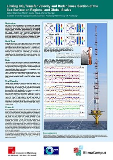
. [[attachment:SOPRAN_I_4.4_BIOCAT_FINO2_Poster2008.pdf|{{attachment:SOPRAN_I_4.4_BIOCAT_FINO2_Poster2008s.jpg|BIOCAT 2008|height="200"}}]] [[attachment:SOPRAN_II_4.4_FINO2_Poster2009.pdf|{{attachment:SOPRAN_II_4.4_FINO2_Poster2009s.jpg|SOPRAN AM 2009|height="200"}}]] [[attachment:SOPRAN_II_4.4_FINO2_Poster2010.pdf|{{attachment:SOPRAN_II_4.4_FINO2_Poster2010s.jpg|SOPRAN AM 2010|height="200"}}]] [[attachment:SOPRAN_II_4.4_FINO2_Poster2012.pdf|{{attachment:SOPRAN_II_4.4_FINO2_Poster2012s.jpg|SOPRAN AM 2012|height="200"}}]] [[attachment:SOPRAN_III_II_FINO2_Poster2013.pdf|{{attachment:SOPRAN_III_II_FINO2_Poster2013s.jpg|SOPRAN AM 2013|height="200"}}]] [[attachment:SOPRAN_III_II_FINO2_Poster2014.pdf|{{attachment:SOPRAN_III_II_FINO2_Poster2014s.jpg|SOPRAN AM 2014|height="200"}}]] ----- . {{attachment:KFEW3O/Grünpfeil.jpg||height=30}} [[KFEW3O/Multi3ScatFINO2/Multi3ScatFINO2intern|{{attachment:KFEW3O/intern_b.jpg|KFEW3O/Multi3ScatFINO2/Multi3ScatFINO2intern|height="30"}}]] ...to the internal pages [[KFEW3O/Multi3ScatFINO2/Multi3ScatFINO2intern|this way]]. . {{attachment:KFEW3O/Grünpfeil.jpg||height=30}} [[KFEW3O|{{attachment:KFEW3O/KFEW3O_b.jpg||height=30}}]]... back to the [[KFEW3O|KFEW3O page]]... |
Scatterometer Measurements on FINO2
FINO2 is the second research platform of the FINO series (FINO = Forschungsplattformen in Nord- und Ostsee; Research Platforms in the North and Baltic Seas) and the only platform in the Baltic Sea. It is located at Kriegers Flak in the Western Baltic Sea, north of the island of Hiddensee, south of the city of Trelleborg and east of the island of Møn, at 55°00'24,94" N 13°09'15,08" E. FINO2 is run by the Germanische Lloyd Garrad Hassan
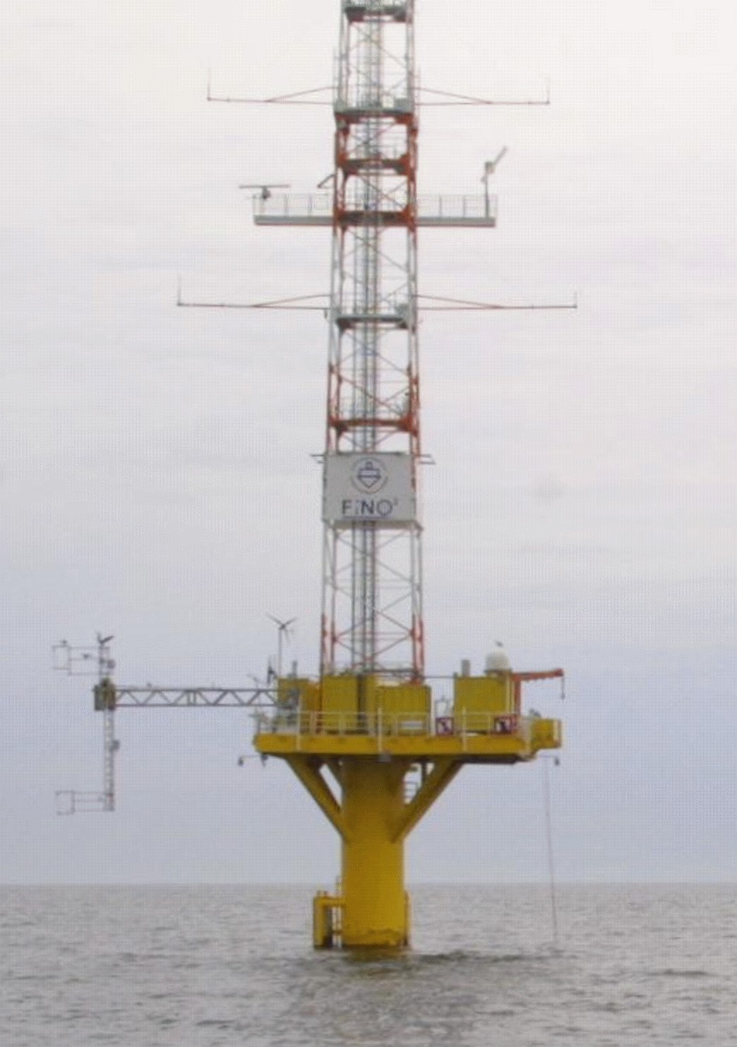
Photograph of FINO2.
Systematic Measurements on FINO2
In the frame of the BMBF project SOPRAN systematic measurements of the radar backscattering from the sea surface were carried out on FINO2 from summer 2011 thru autumn 2013. Installed was the platform version of U Hamburg's Multi³Scat, which allowed continuous radar backscatter measurements at five frequencies and four polarization combinations.
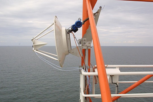
Wideband antenna of Multi³Scat on FINO2.
Poster

 ...to the internal pages this way.
 ... back to the KFEW3O page...

